Beyond Highways: How India’s New Rail Corridors Are Changing Urban Growth
For decades, India’s property story was relatively easy to understand.
Build a road.
Build a flyover.
Put up a billboard saying “future growth corridor.”
Then wait for the apartment advertisements to arrive.
Railways are making that equation considerably more interesting.
India’s expanding railway infrastructure is increasingly doing more than moving passengers and freight. New tracks, tunnels, bridges, viaducts, regional rail systems and redeveloped stations are beginning to influence where people live, where businesses locate and how the edges of cities develop.
The country’s Public Private Partnership Appraisal Committee (PPPAC) database provides a useful snapshot. In 2026, projects under the railway-track category — covering tracks, electrical and signalling systems, tunnels, viaducts and bridges — have a combined listed value of about ₹1.35 lakh crore across 16 projects. A separate category covers railway terminal infrastructure, including stations and adjoining commercial infrastructure.
That is not simply a railway construction programme.
It is potentially an urban-growth programme hiding inside a transport programme.
The station is becoming an economic node
The traditional railway station was largely a place where you arrived, bought a ticket and tried not to lose your luggage.
The emerging model is different.
Station redevelopment increasingly combines transport with commercial activity, offices, retail, hospitality and other urban uses. The PPPAC database, for example, separately records railway-terminal infrastructure involving stations and adjoining commercial infrastructure.
This changes the economic role of the station.
A railway station can become a destination rather than merely a doorway.
And once that happens, surrounding land begins to acquire a different economic logic.
Retailers want footfall.
Hotels want travellers.
Offices want accessibility.
Developers want locations where thousands of people can arrive without depending entirely on private vehicles.
The railway station, in other words, starts behaving a little like a miniature economic city.
The Namo Bharat experiment
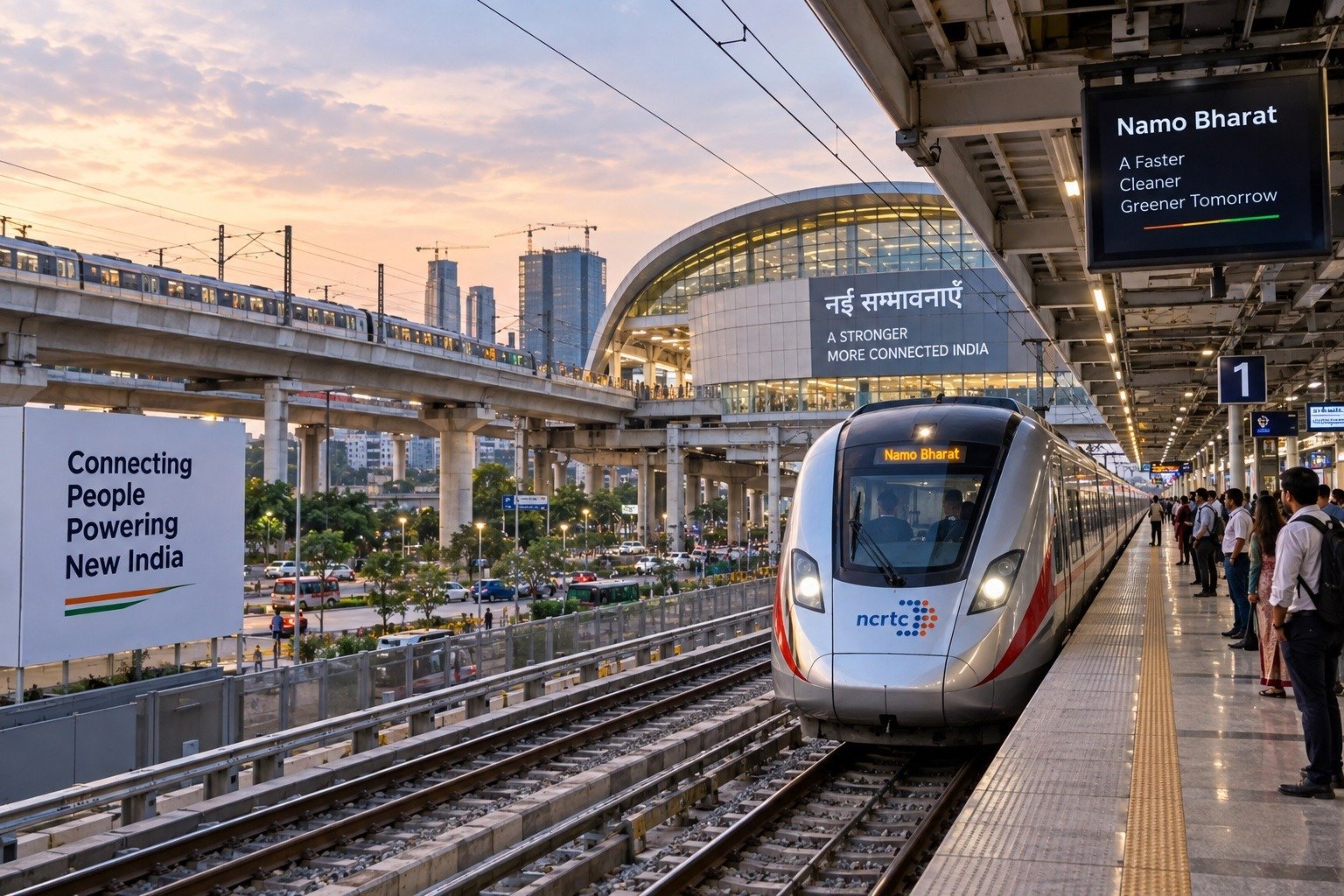
The clearest contemporary example is India’s Regional Rapid Transit System.
The Delhi–Ghaziabad–Meerut Namo Bharat corridor was designed not simply as an extension of a city metro but as a regional system connecting major urban nodes. NCRTC describes Namo Bharat as a high-speed, high-frequency regional railway intended to connect urban centres across the National Capital Region.
The difference matters.
A metro primarily helps a city move within itself.
Regional rail can change the practical relationship between cities.
A person living outside the traditional metropolitan core can potentially access employment, education and commercial centres without relocating into the most expensive parts of the city.
That is where railway infrastructure begins to influence urban geography.
Delhi–Meerut is also a property-planning experiment
There is an even more revealing development.
NCRTC is not hiding the property connection.
Its Transit Oriented Development programme explicitly explores TOD, Land Value Capture and Value Capture Financing along Namo Bharat corridors. NCRTC says better connectivity can encourage commercial, cultural, institutional and residential development around transit corridors and increase land values in surrounding areas.
In February 2026, NCRTC also held a stakeholder consultation specifically on commercial and TOD opportunities along the Delhi–Meerut Namo Bharat corridor, bringing together real-estate developers, investors, hospitality players and other organisations.
That is significant.
The question is no longer simply:
“How many passengers will the railway carry?”
It is increasingly:
“What kind of city should grow around the railway?”
The next suburbs may not look like today’s suburbs
India’s urban expansion has often been driven by roads.
New highways make peripheral land easier to reach, after which housing, warehouses, institutions and commercial development follow — sometimes in an orderly fashion and sometimes in a rather enthusiastic fashion involving a concrete boundary wall and a giant “future township” hoarding.
Rail-based growth offers another model.
If stations are properly integrated with buses, metros, walking infrastructure, cycling and local roads, development can concentrate around transport nodes rather than simply spreading outward.
The Ministry of Housing and Urban Affairs’ National TOD Policy has long promoted integrated land-use and transport planning, with compact, mixed-use development around mass-transit stations. The policy specifically seeks to reduce urban sprawl and private-vehicle dependence.
This is important because connectivity alone does not create good urbanisation.
Planning does.
From railway line to economic corridor
The effect is even larger when railways are carrying freight.
A new freight corridor or railway link can change the economics of an industrial region because manufacturers care deeply about transportation cost, reliability and access to markets.
A current Maharashtra example illustrates this well.
The 38.21-km Mukutban–Gadchandur railway line, approved at a cost of ₹493 crore in September 2026, is intended to provide an alternative route for freight and passenger movement while easing congestion on the Wardha–Manikgarh route.
The project connects industrial and mining areas in Yavatmal and Chandrapur, including cement plants and coal and limestone mines. It is projected to handle about 6.08 million tonnes of freight annually, including coal, cement, fertiliser and foodgrains. Two daily MEMU services in each direction are also planned.
This is precisely where the railway-property relationship becomes more complicated.
The first beneficiary may not be a housing project.
It may be a factory, warehouse, mine, processing unit or logistics business.
Housing and commercial development can follow employment.
The Northeast tells another story
Railway infrastructure can also change the economic geography of regions where terrain and distance have historically imposed high connectivity costs.
Tunnels, bridges and viaducts are particularly important in difficult terrain.
The Rishikesh–Karnprayag railway project in Uttarakhand, for example, involves a 125-km new broad-gauge line through challenging Himalayan terrain. Recent progress has included the 41st tunnel breakthrough and completion of a 10.847-km escape tunnel.
Its significance extends beyond the engineering achievement.
Better railway connectivity can change access to tourism centres, pilgrimage destinations, local markets and services. But mountainous infrastructure also requires particularly careful attention to environmental impact, slope stability, disaster resilience and carrying capacity.
A train can bring visitors.
It can also bring pressure.
That is why “connectivity” should never be treated as synonymous with “development.”
The danger of the railway premium
There is a legitimate economic argument that improved transit can increase the attractiveness and value of nearby land.
But this creates a potential problem.
If land prices rise faster than local incomes, the people who were supposed to benefit from better connectivity may find themselves priced out of the very neighbourhoods the infrastructure was intended to improve.
NCRTC’s own TOD framework recognises that rising land values can be captured through mechanisms such as additional floor-area rights, development charges and other value-capture instruments.
That is a sophisticated approach, but it raises an equally important question:
Who captures the value created by public infrastructure?
If the answer is only landowners and speculative investors, the public investment has a narrower social return.
If part of the additional value helps finance transport, affordable housing, public spaces, pedestrian infrastructure and local services, the railway can help build a more balanced city.
Connectivity must meet the last mile
There is another lesson India has learned repeatedly: a fast train is only as useful as the journey to the station.
NCRTC’s planning therefore emphasises multimodal integration with Indian Railways, metro systems, airports and bus depots.
This may sound like a technical detail.
It isn’t.
A passenger who spends 15 minutes on a fast regional train but another 45 minutes searching for an auto, waiting for a bus and walking through an unsafe road environment has not experienced truly efficient mobility.
The railway must therefore be connected to the city around it.
Station + bus + metro + walking + cycling + housing + jobs is the real equation.
India’s next urban map could be a railway map
The PPPAC pipeline shows that rail investment is extending across multiple dimensions — railway tracks, tunnels, bridges and viaducts, alongside station and commercial infrastructure.
At the same time, regional rail systems such as Namo Bharat are explicitly being planned around economic and urban nodes.
The result could be a gradual change in India’s mental map of the city.
Instead of thinking only in terms of Mumbai, Delhi, Bengaluru, Hyderabad or Pune, we may increasingly think about connected urban regions containing several cities, industrial centres and satellite towns.
That is a profound shift.
The railway does not merely connect two points.
It can make the space between those points economically usable.
The DOONITED View
India should be careful about turning every new railway station into a property-sales opportunity.
The smarter objective is to turn railway investment into productive urbanisation.
That means employment near stations, mixed-use neighbourhoods, affordable housing, reliable feeder transport, pedestrian access, logistics connections and public spaces.
The property market will notice railway infrastructure whether planners like it or not.
The real policy challenge is making sure urban planning notices it first.
Because a railway corridor can create land value.
But only good planning can turn that land value into a better city.
The Learning Point
The biggest economic impact of a railway may not be the journey it shortens, but the geography it makes possible.
India’s next generation of towns may therefore grow not simply beside highways, but around stations — provided connectivity is matched by jobs, housing, services and intelligent planning.
The railway timetable may tell us when the train arrives.
The urban plan will determine what arrives with it.

World Beyond the News
Why Elephants Stay Close to Their Herd
Elephants live in highly social family groups and use calls, touch and body movements to maintain strong bonds.
Most of the Deep Ocean Remains Difficult to Explore
Extreme pressure, darkness and distance make deep-ocean exploration one of Earth’s greatest scientific challenges.
Spacecraft Can Travel Without Traditional Roads
Spacecraft use carefully calculated trajectories and gravity assists to travel enormous distances through space.
Why Movie Trailers Are Released in Stages
Major films often use teaser trailers, full trailers and final promotional spots to build awareness over time.